GetYourGuide3 hours
Lanzarote: Hike Across Timanfaya's Volcanic Landscapes
4.8 (1,533)
from €44Check availability
Whole islandWalking routes · volcanoes and cliffs
The best hiking trails in Lanzarote are short, shadeless and on lava. Inside Timanfaya you can only walk with the park's own guides, free of charge and booked a month ahead; everything else you can do on your own.
From Puerto del Carmen27 min20 km · by car, no traffic
Updated 5 October 2026Facts checked against official sourcesContains affiliate links
6 options · Prices checked on 5 October 2026
GetYourGuide3 hours
4.8 (1,533)
from €44Check availability
GetYourGuide3 hours
4.8 (982)
from €47Check availability
Tiqets
5.0 (1)
from €55Check availability
GetYourGuide4 hours
4.9 (214)
from €47Check availability
GetYourGuide3.5 hours
5.0 (22)
from €54Check availability
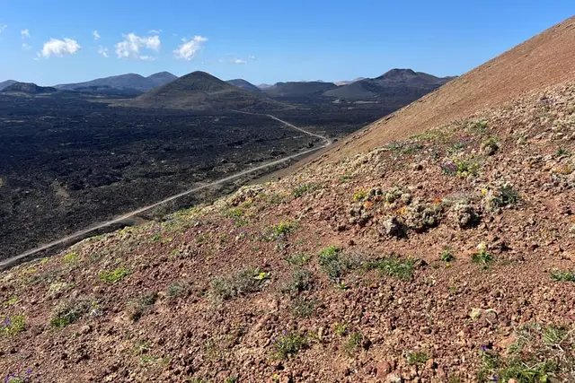
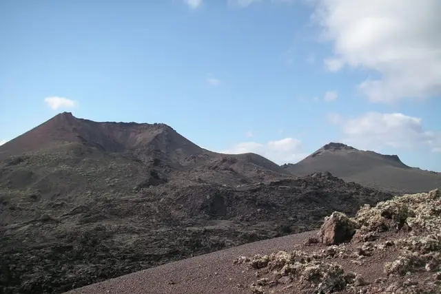
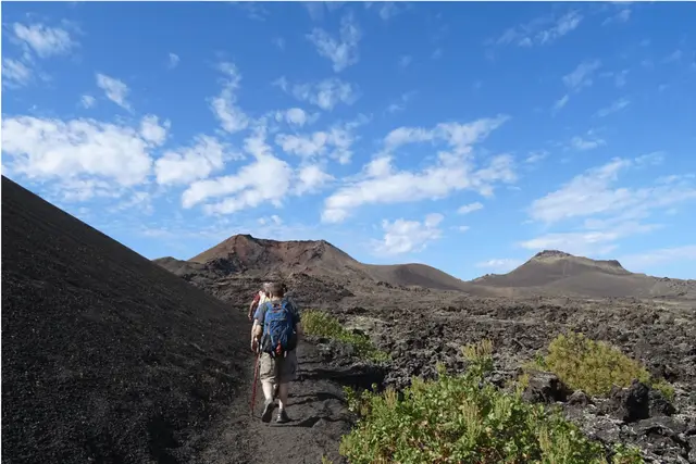
Hiking in Lanzarote is not high-mountain walking: it means crossing lava flows nearly three centuries old, walking into a crater and peering into calderas that look as if they have only just gone out. The routes are short, mostly 1 to 3 hours, but there is no shade and no water, and the wind on the ridges blows harder than on the beach.
What confuses most visitors: you cannot explore Timanfaya National Park on foot by yourself. Apart from the long coastal route, there are only two guided walks inside, led by the park's own guides, free of charge and booked a month ahead. The "Timanfaya" hiking tours sold on booking platforms walk in the Parque Natural de Los Volcanes, right next door. They are good routes, but it helps to know where you are.
| Route | Distance | Time | Difficulty | Permit |
|---|---|---|---|---|
| Caldera Blanca (Mancha Blanca) | about 10 km | about 3 h | moderate (length) | no |
| Volcán del Cuervo + Montaña Colorada | 2.5–4.5 km | 60–90 min | easy | no |
| Los Ajaches from Femés | 5.8 km | — | moderate, with climbing | no |
| Montaña Roja (Playa Blanca) | out and back to the crater | 1 h | easy | no |
| Tremesana (Timanfaya, guided) | 3–3.5 km | about 3 h with transfers | easy | free booking |
| Short Coastal Route (guided) | 2–2.8 km | 2.5–3 h | moderate | free booking |
| Long Coastal Route | 9.75 km | 5–6 h | hard | no |
| Camino de Los Caleteros (Famara) | — | — | — | closed |
Caldera Blanca, the Volcán del Cuervo and the Timanfaya routes have no bus ("guagua") to the trailhead: route 5 serves Femés, and you can walk up to Montaña Roja from Playa Blanca. For the rest you need a car, a taxi or a tour with pick-up; we explain the options in Lanzarote without a car.
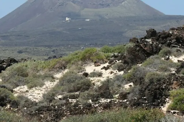
This is the island's big self-guided hike. It is about 10 km there and back (9.97 km according to the Canary Islands tourist office), about 3 hours, starting from the church of Nuestra Señora de los Dolores in Mancha Blanca. The path crosses the "malpaís" (badlands) of the 1730–1736 eruptions on footpaths, tracks and the odd paved stretch, almost flat as far as the base of the cone.
The tourist office rates it as suitable for everyone, and technically that is true. What tires you is the sun: black rock, not a single tree and no water along the whole route. Bring sun cream and enough to drink for three hours, and set off early. Up on the rim of the caldera, the wind hits hard even in summer.
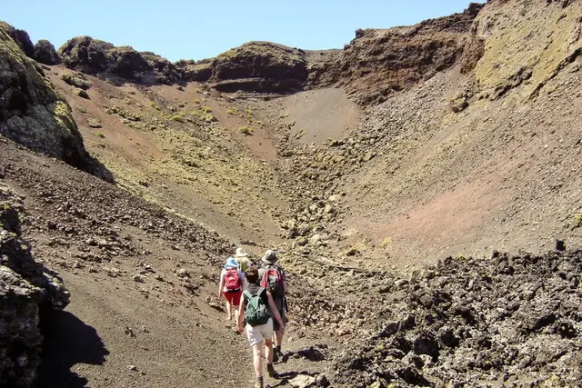
If you are only going to walk once, or you have small children with you, this is the route. It starts from a dirt car park on the LZ-56, about 2.5 km from Masdache, and is signposted. The Cabildo (island council) lists it as "Sendero Volcán del Cuervo": 2.5 km, easy. The best part is that you walk right inside the crater.
The short version is about 3 km; if you link up with Montaña Colorada, the loop grows to about 4.5 km. Allow 60 to 90 minutes, on volcanic gravel that digs into thin soles. It is all within the Parque Natural de Los Volcanes, outside the national park, so you do not need to book.
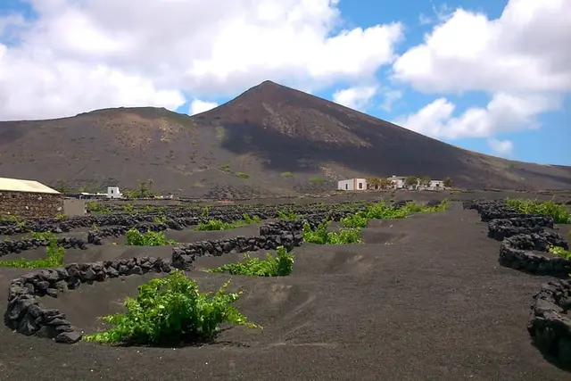
The car park is a few minutes from the wineries of La Geria: an early walk followed by a winery visit and tasting makes a well-rounded morning.
In the south, above Playa Blanca, Los Ajaches are the oldest part of Lanzarote: bare ridges and ravines, nothing like the black volcanoes of the centre. The official route starts in Femés, is 5.8 km long and has "a notable gradient". Take food and drink.
It is the only route on this page served by bus: route 5 Arrecife–Femés stops in the village (check timetables at https://arrecifebus.com/lineas/). From Playa Blanca, Femés is a few minutes' drive.
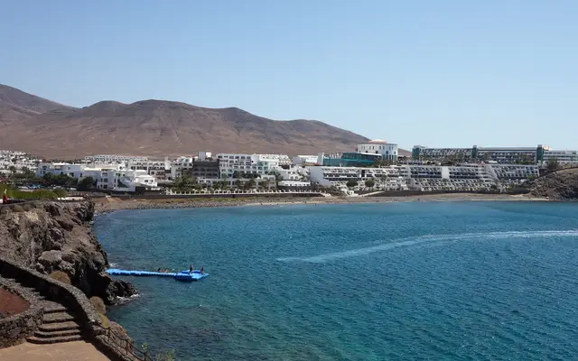
Montaña Roja (196 m) rises at the eastern end of Playa Blanca and is the only one of these routes you can reach on foot from the Playa Blanca hotels. The path is edged with volcanic stone kerbs up to the rim of a crater about 350 m wide and 50 m deep. Allow an hour, ideally late in the afternoon to catch the sunset. Stay on the marked path: the kerbs are there to stop erosion.
Inside Timanfaya National Park you cannot walk freely: only on authorised paths, no dogs, no drones and no taking stones. The park offers two guided routes led by its own guides, free of charge, booked on the Spanish National Parks booking website.
This is the only way to walk through the interior of the park. About 3–3.5 km in roughly 3 hours with transfers, easy, five days a week. You meet in the Plaza de Los Remedios in Yaiza, 15 minutes beforehand. Along the way you see "jameos" (collapsed lava tubes), the contact between aa and pahoehoe lava at Montaña Hernández, and lava stalactites.
The conditions are strict: minimum age 16 (16–17 with an adult), maximum 8 people, closed trainers and photo ID. There are groups in Spanish and in English, booked as separate activities, and you must understand the group's language. It is called off if there is a yellow, orange or red weather warning.
It starts in El Golfo, from the car park at the north end of the village next to the playground, and heads to Playa del Paso: 2–2.8 km in 2.5–3 hours, moderate, also 16+ and a maximum of 8. Walking boots and water are compulsory: without them you may lose your place. You must stay on the path, because the cliff crumbles and seabirds nest there. It fits well with a visit to the Charco de los Clicos in El Golfo.
This one is neither guided nor permit-only. It runs from Playa de la Madera (Tinajo) to El Golfo via Punta del Jurado: 9.75 km, 5–6 hours, hard. At high tide the sea splashes you, there is no mobile signal on long stretches and a rescue can only arrive on foot. For something gentler, the park recommends the out-and-back from Playa de la Madera to Playa del Cochino, about 9 km.
How to book Tremesana or the Coastal Route
For questions, the park's visitor service answers on +34 928 118 042 and at usopublico.timanfaya@gobiernodecanarias.org.
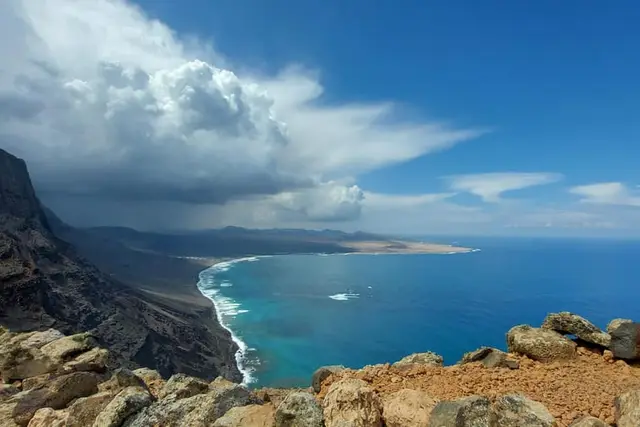
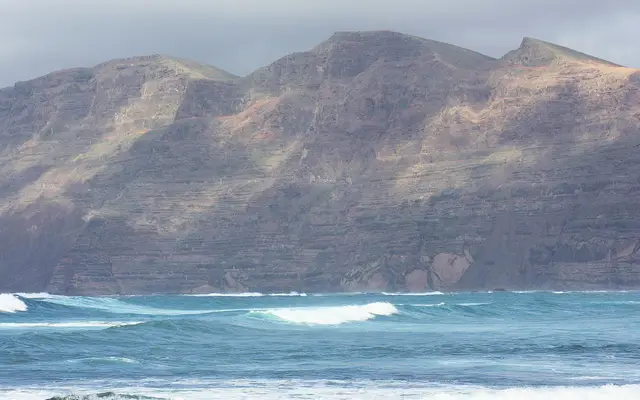
The clifftop path along the Risco de Famara, the Camino de Los Caleteros between Famara beach and Playa del Risco, has been closed since the landslide of 12 May 2026. About 25 m of hillside came down almost to the shore, and the Cabildo, together with Haría and Teguise councils, closed the section from the "Casa del Agua", halfway up the slope, to the junction with the path up to Guinate. There are no-entry signs. A reopening was promised "as soon as possible", but it is currently still closed with no date: check the Cabildo de Lanzarote notices before you go.
The other path down the cliff, the Camino de los Gracioseros, descends to Playa del Risco, opposite La Graciosa. It is moderate to hard, on slippery rock. Before you go, check with the Cabildo whether the closure affects it, and respect the signs. If a guided walk advertises "Risco de Famara", ask which section it covers.
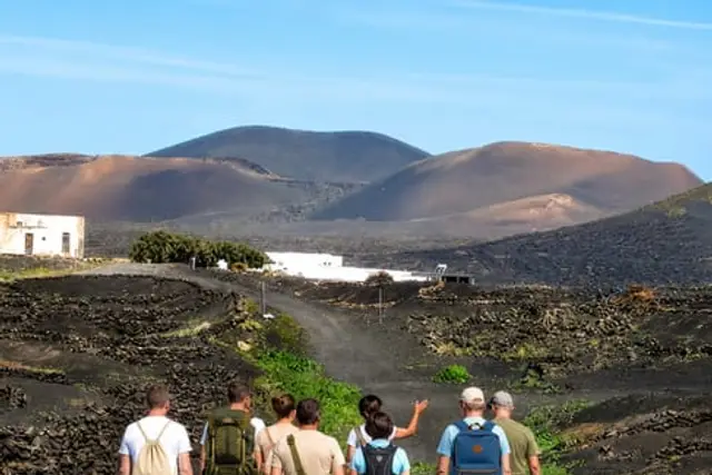
The most-reviewed hiking tours on GetYourGuide have "Timanfaya" in the name, but no company can take walkers into the core of the national park. They walk in the Parque Natural de Los Volcanes, the protected belt around it: Volcán del Cuervo, Montaña Colorada, Caldera Blanca. It is the same 1730–1736 landscape, not the Montañas del Fuego area.
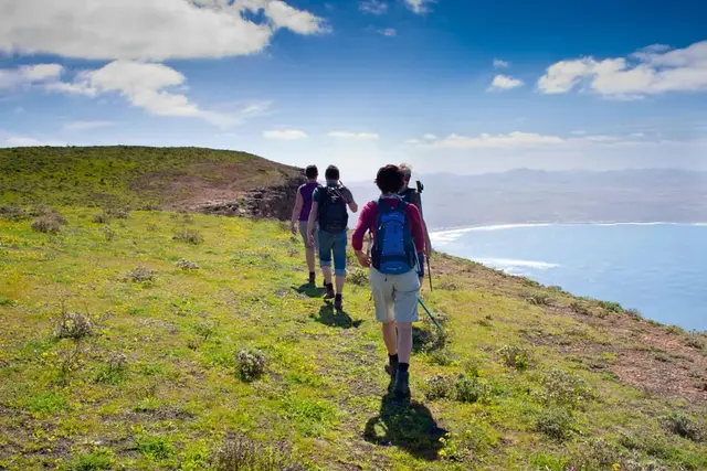
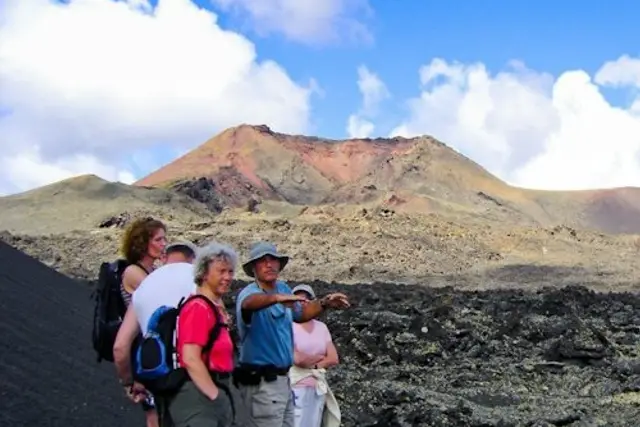
What a guide adds: a hotel transfer (on the tours that include one), geological explanations and no worrying about parking. What a guide does not add: access to closed areas. If you have a car and can manage with a map, the Volcán del Cuervo is free on your own. If you do not have a car, the version with transfers solves the problem of reaching a trailhead with no bus.
The guided walks we would choose
1
No car
Volcano route with transfers included, 3.5–4 h. Rated 4.9 from nearly a thousand reviews, and one of the cheapest.
GetYourGuide3.5 - 4 hours
4.9 (948)
from €42Check availability
2
First timers
The most-reviewed walk on this list (more than 1,500 reviews), 3 h through the volcanoes of the natural park.
GetYourGuide3 hours
4.8 (1,533)
from €44Check availability
3
Wine lovers
A 4-hour walk through La Geria, rated 4.9. Volcanoes and vines in the same morning.
GetYourGuide4 hours
4.9 (214)
from €47Check availability
4
Already know the south
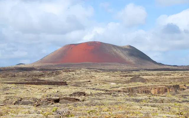
A northern route up to La Corona volcano. Very few reviews so far: choose it for the area, not the rating.
GetYourGuide3.5 hours
5.0 (1)
from €44Check availability
GetYourGuide3.5 - 4 hours
4.9 (948)
from €42Check availability
Tiqets
5.0 (1)
from €53Check availability
GetYourGuide3.5 hours
5.0 (10)
from €48Check availability
GetYourGuide3.5 hours
5.0 (1)
from €44Check availability
GetYourGuide2 hours
4.5 (2)
from €60Check availability
GetYourGuide4 hours
No reviews yet
from €39Check availability
See all on GetYourGuide →Prices checked on 5 October 2026
There is also Uniguides, a cooperative of professional guides offering walks in many languages, including Polish, Russian and Swedish. A good fit if you want a guide in your own language.
Only with the park's guides: the Tremesana route and the Short Coastal Route, both free, for over-16s and in groups of 8, booked on the National Parks website about 25–30 days ahead. The Long Coastal Route, along the park's coastline, can be walked on your own without a permit.
No. Guided walks sold with "Timanfaya" in the name take place in the Parque Natural de Los Volcanes, next to the national park (Volcán del Cuervo, Montaña Colorada, Caldera Blanca).
The Volcán del Cuervo: 2.5–3 km, about 60 minutes, signposted, and you walk into the crater. Good with children. From Playa Blanca, Montaña Roja is another short climb of about an hour.
The Camino de Los Caleteros, along the Risco de Famara, has been closed since the landslide of 12 May 2026, with no reopening date. Check beforehand whether the closure affects the Camino de los Gracioseros.
To Femés (route 5 from Arrecife), where Los Ajaches begins; Montaña Roja is a walk from Playa Blanca. Caldera Blanca, the Volcán del Cuervo and the Timanfaya routes have no bus to the start: you need a car, a taxi or a tour with transfers.
No. Only the two guided routes in the national park need booking. Everywhere else, stay on the marked path.
If you want more volcanoes with less walking, look at the buggy or bike options, or the full list of things to do in Lanzarote.
Booking calendars The GetYourGuide and Tiqets calendars are loaded by those companies and may use cookies. This site uses no cookies of its own and no analytics. More information